Primary tabs
You don't need to be an ALA Member to purchase from the ALA Store, but you'll be asked to create an online account/profile during the checkout to proceed. This Web Account is for both Members and non-Members. Note that your ALA Member discount will be applied at the final step of the checkout process.
If you are Tax-Exempt, please verify that your account is currently set up as exempt before placing your order, as our new fulfillment center will need current documentation. Learn how to verify here.
- Description
- Table of Contents
- About the authors
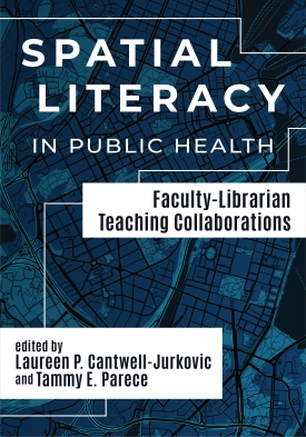
Spatial literacy—the ability to visualize, understand, and use the properties of space to communicate, reason, and problem-solve—is relevant across a wealth of disciplines. Spatial Literacy in Public Health: Faculty-Librarian Teaching Collaborations offers ideas and plans for collaborative spatial literacy teaching and learning initiatives focusing on geographic information systems (GIS)-based and GIS-related instruction through the lens of public health topics.
Chapters include step-by-step learning activities, teaching tips, recommended readings, and four-color maps as well as other useful illustrations—these not only support student learning, but also professional development for librarians interested in spatial literacy instruction and in pitching such instruction to potential faculty collaborators. Interdisciplinary topics include supply chain management, social media campaigns, data visualization, racial disparities, and other demographic themes related to immunization patterns, epidemiology, recreation access, and community health and environmental health/environmental science.
Spatial Literacy in Public Health offers specific plans for collaborative, interdisciplinary spatial literacy instruction and activities. Chapters also connect with supplementary content in the ACRL Framework for Information Literacy Sandbox (https://sandbox.acrl.org), including activity-focused slide decks and more, all findable with the tag “#SpatialLit” and freely available. Learning activities support open-source tools, open educational resources (OER), and other institutional cost-saving initiatives, and the ability to adapt from in-person to virtual instruction settings.
Introduction
Laureen P. Cantwell-Jurkovic and Tammy E. Parece
Part I. Beginner Concepts, Learning Activities, and Skills
Chapter 1. Fundamentals of Spatial Data for Public Health
Forrest J. Bowlick and Aída R. Guhlincozzi
Chapter 2. Evaluating GIS Data Using the Currency, Relevance, Authority, Accuracy, and Purpose (CRAAP) Test
Bryan Fuller and Martin G. Ndegwa
Chapter 3. Participatory Mapping for Public Health
Jugal Patel and Nicolas Parent
Chapter 4. Using Geospatial Visualizations to Better Understand Public Health Data
Aaron M. Adams, Debarchana Ghosh, Xiang Chen, Weidong Li, Chuanrong Zhang, Adam Gallaher, and Ashley G. Benítez Ou
Chapter 5. Mapping and Evaluation of Community Resources, Access, and Populations Using Public-Use Software and Data Files
Wladimir Labeikovsky and Dana Abbey
Chapter 6. Visualizing Public Health Data: Using the U.S. Covid Atlas and GeoDa for Spatial Insights
Cecilia Smith and Marynia Kolak
Part II. Intermediate Concepts, Learning Activities, and Skills
Chapter 7. Easily Map Socioeconomic Variables for Public Health Courses: Introductory Mapping Tools for Public Health Exploratory Research
Todd Quinn and Sarah Shrum Davis
Chapter 8. Tracking Disease Outbreaks and Health Communication with Social Media Analytics and GIS
Ming-Hsiang Tsou, Eyal Oren, and Atsushi Nara
Chapter 9. Anticipating a Post-Disaster Supply Chain Disruption
Chapter 10. Analyzing Spatial Clusters for Multiple Attributes: A Case Study for Obesity and Sleep Deficiency
Lucy Cousins and Seda Şalap-Ayça
Part III. Advanced Concepts, Learning Activities, and Skills
Chapter 11. Spatial Epidemiology: Spatial Clustering and Vulnerability
Bartholomew Hill, Harriet Moore, and Frank Tanser
Chapter 12. Built Environment and Physical Activity: Online GIS Technology for Mapping Environment-Behavior Relationships
Muntazar Monsur
Chapter 13. Geospatial Tools for Environmental Health Issues
Chunrong Jia
Chapter 14. Student Involvement in Soil Collection for Environmental Lead (Pb)
Matthew L. Sisk, Heidi Beidinger, Marya Lieberman, and Meghanne Tighe
About the Editors / Authors
Laureen P. Cantwell-Jurkovic
Laureen P. Cantwell-Jurkovic, PhD, MSLIS, is the Head of Access Services & Outreach at Colorado Mesa University’s Tomlinson Library. She co-edited Finding Your Seat at the Table: Roles for Librarians on Institutional Regulatory Boards and Committees (Rowman & Littlefield, 2022) and was sole editor for Intersections in Healing: Academic Libraries and the Health Humanities (Rowman & Littlefield, 2024). She has also published book chapters and articles on topics ranging from librarians on IRBs to libraries and MOOCs, from library spaces as curiosity drivers to Covid-era curbside pickup services, from information literacy activism to digital badging, and more. As part of being liaison to CMU’s Davis School of Business, she works with students and faculty within entrepreneurship, marketing, and other concentrations to bring GIS tools and research opportunities into their lives.
Tammy E. Parece
Tammy E. Parece, PhD, is an Assistant Professor of Teaching with The Ohio State University in Columbus, Ohio where she teaches geospatial technologies to undergraduate and graduate students. She has a Geospatial and Environmental Analysis PhD from Virginia Tech. Her research includes the physical and social evaluations of urban areas for urban agriculture. She has published several book chapters and journal articles, and presented many conference papers, related to urban agriculture. Additionally, she specializes in geographic education, including geospatial technology courses. Her publications include book chapters, journal articles, and several technical and laboratory manuals related to geospatial technology education. She has taught numerous professional development workshops in geospatial technologies. Additionally, she taught at Colorado Mesa University, both traditional geography courses and geospatial technology courses, from 2016 - 2022, and developed their Geography Education and Outreach Program.


